A restoration project last year allowed this wetland to flood while an infamous stretch of Highway 101 stayed dry this winter.
Courtesy of North Coast Land Conservancy
Every winter on Oregon's north coast, the Necanicum River spills out over its banks during heavy rains and swallows the road just south of Seaside. This happens at least once -– and up to seven times -- a year.
But not this year.
Last summer, highway officials teamed up with a local landowner to use a nearby wetland as a natural sponge for floodwater. By removing a mile-long wall of dirt, they freed the river to spread out into its natural flood plain. Since then, even when the Necanicum has over-topped its banks, it hasn't sent its waters to flood the highway.
It's a big change from how things used to be.
Driving Through A Lake
You can see just how bad the highway flooding used to get in this YouTube video from 2003. The woman videorecording from the front passenger's seat captures the view from the dashboard as her car drives through the flood water, which at one point reaches almost as high as the passenger window.
br>The only indication that the car is actually on a road is the line of cars driving the other direction.
"Oh, my God," she says. "This is a lot worse than I thought. ... We are in a lake."
Larry McKinley, regional manager for the Oregon Department of Transportation, says sometimes crossing that lake could be just too dangerous. When floodwater on the road reaches a foot or higher –- typically at least once a year and often two or three times -– his agency closes the highway to cars that aren't big enough to make it across. Otherwise, he says, they could float away.
“When you get that flowing water –- and it would move very quickly across there -– it would actually pick them up off their wheels and they’d start moving onto the other side," he said. "And there’s a very deep ditch on the other side.”
A Road In A Floodplain
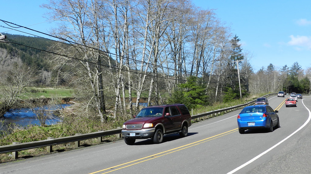
The Necanicum River runs along Highway 101 south of Seaside.
Studies identified two culprits for the flooding problem. One: the highway was built in the Necanicum River floodplain. And two: the rest of the floodplain was walled off by a berm – a four-foot mound of dirt that trapped the river against the highway for about a mile.
"The highway is built in right on the flood plain in the worst spot," says Vaughn Collins, an engineer with Northwest Hydraulic Consultants. The firm was hired to study the problem and design some solutions. "The number one thing that needed to be done was getting that berm out of there."
Collins presented two other options that involved raising the highway above the flood water, but they would cost millions of dollars more.
"The cost of those types of projects were far greater than removing this old berm in a farm field," he says. "It was nice because not only was it the most effective at flood reduction, but it was also the least costly of the alternatives we were looking at."
By removing the berm, the flood water would be free to spread out over 125 acres of pastureland on the other side. The best part of that plan? The owner of the pasture actually wanted it to flood.
Turning A Pasture Back Into A Swamp
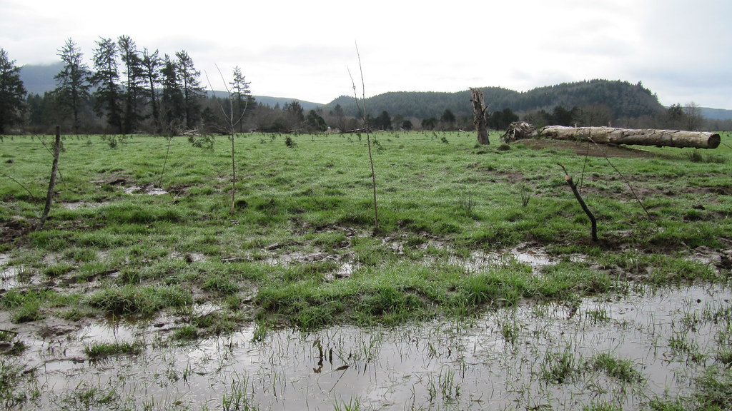
Allowing the Necanicum River to flood this pasture kept Highway 101 dry this winter.
In 2003, the North Coast Land Conservancy bought 364 acres alongside Highway 101 -– including the pasture. The group manages 3,000 acres of habitat in the region, and it was planning to turn the pasture back into what it used to be: a forested swamp that doubles as a salmon nursery.
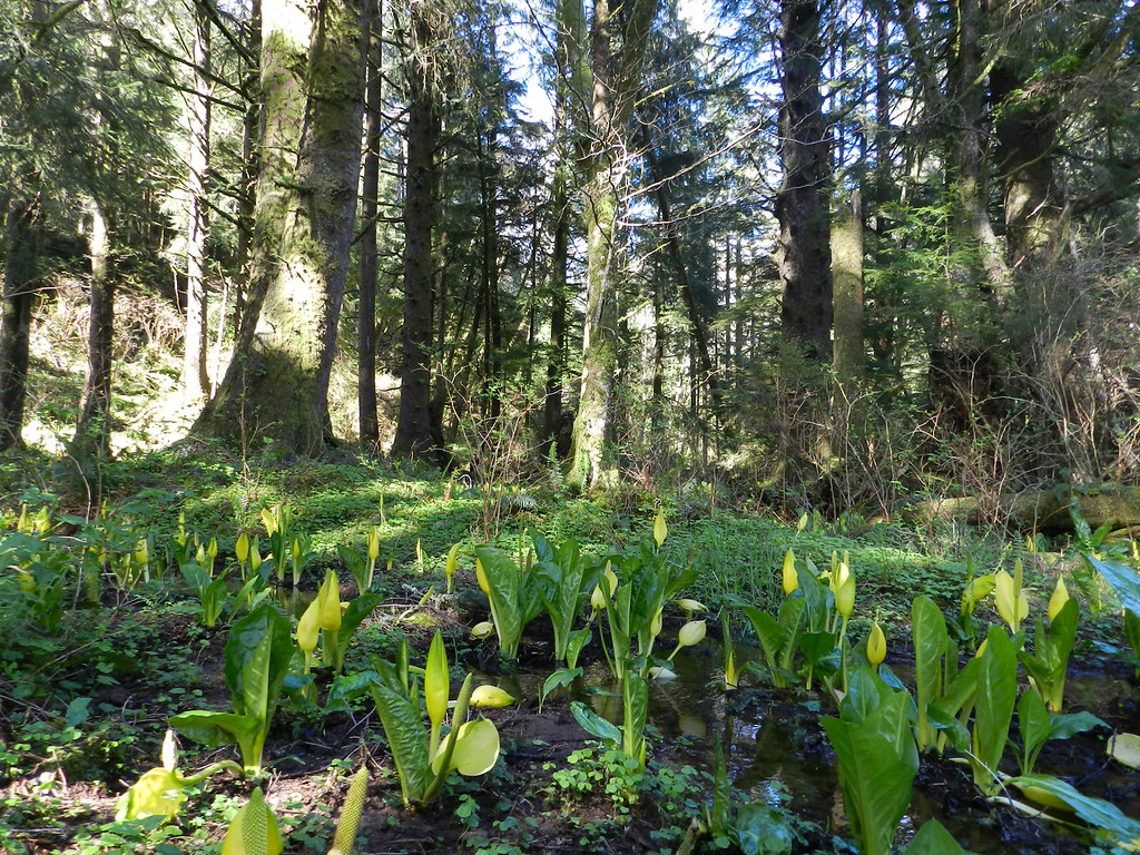
Remnants of that swamp still exist along the western edge of the property. It's what drove the land trust to buy the land in the first place, says conservancy director Katie Voelke. That swamp serves as a reference for what the rest of the property once looked like, before it was cleared of trees and drained of flood water.
As transportation officials weighed their options for fixing the highway, conservancy director Katie Voelke assured them that, yes –- really –- they could --– and should –- flood her property.
“We said bring it on," she says. "We’ll take as many flood waters as you want to give us.”
The pasture along Highway 101 used to look like this.
For Voelke, flood water is like a habitat delivery service. It carries nutrients that feed native plants and nurture the base of the food chain.
"It's like augmenting the soils," she says. "Bringing the compost to the garden."
To turn a cow pasture back into a forested wetland, Voelke says, her land needs those nutrients. But taking out a mile-long berm was too big a job for her land trust.
Breaking Down The Berm
A plan snapped into place when ODOT realized it could use Voelke’s flooded property as a wetland mitigation bank – place where the agency gets credit for restoring wetland habitat that it can use later to offset damage to wetlands from road work in the area.
Tapping state funds for wetland mitigation allowed the agency to tackle two of its own problems –- the highway flooding and future impacts to wetlands –- while simultaneously helping the land trust convert its pasture into a swamp.
So, last summer, ODOT paid to remove almost a mile of berm along the highway and start turning the pasture into a wetland. This winter, everyone watched to see whether the river’s flood water would now flow into the pasture instead of covering the highway.
Indeed, that’s exactly what happened. The water level in the river dropped 18 inches –- enough to keep the water off the road –- while flood waters poured into the land conservancy's pasture.
“This year we’ve had two flood events," McKinley says. "The last one, in February, was a very major high water event, and in the area of Circle Creek Campground where it’s always flooded before, it didn’t flood this time.”
Letting Nature Handle Flood Control
The flooded pasture. Credit: North Coast Land Conservancy
The first major flood event to test the berm removal solution happened right after the work was finished last September.
"For days and days the floodplain was just hundreds of acres of water," Voelke says. "You looked out and what used to be pasture was water. There were thousands of birds that flocked in to use it. It just looked like an amazing wildlife refuge."
Voelke compares the solution to allowing the river to fill a bathtub instead of a sink during high water.
"It’s the same amount of water, the same power, but you have a bigger bathtub," she says. "That’s what our floodplain is.”
During heavy rains in February, Cannon Beach Mayor Mike Morgan drove up from his town south of Seaside and watched as the pasture flooded while the highway stayed dry. He says for him it drives home the idea that people could let nature handle flood control more often.
"I think the lesson in the long run for engineers who like to bury pipes and install pipes is that natural engineering really works," he says.
Casey Corkrey plants willow trees in the pasture.
As part of the project, workers have planted thousands of trees in the pasture. When they grow up, Voelke says, they’ll make the wetland even more valuable in soaking up flood water.
"A tree drinks water," she said. "When you start to have a whole forest sucking up that water across the whole landscape, you start to have vertical storage."
Engineers and road officials say they're not sure whether the newly restored wetland will eliminate all flooding on Highway 101 or just reduce the frequency and intensity of it.
"We knew the berm removal was going to work well," Collins says. "It's actually worked better than we thought it was going to work. But it might not be enough. It's still a road built on a floodplain."


