Monday was a record-breaking snow day in Central Oregon, as winter storm systems closed schools and businesses on both sides of the Cascades, including the Redmond airport.

Flurries accumulated on freshly shoveled driveways after a winter storm system hit Bend, February 25, 2019.
Emily Cureton / OPB
The National Weather Service recorded 12.5 inches falling on Bend over a 24-hour period. That broke a century-old record for February, as flurries continued accumulating Monday afternoon. It was the fifth snowiest winter day in Bend since record-keeping started in 1901.
Prineville also got a superlative 24-hour dump, with 9.9 inches breaking the previous record of 1.5 inches for Feb. 25 snowfall, set in 1924. Monday marked the second highest single day accumulation for a single day in February in the town's history.
NWS Pendleton meteorologist Marc Austin said this is welcome news before fire season.
“Since Feb. 1, we’ve reached close to 100 percent of our normal snowpack,” Austin said. “It’s a good thing, but if we melt too fast there are also flood concerns.”
Related: February Storms Have Helped, But The PNW Could Still Face Drought
NWS forecasts even more snow for Central Oregon this week.
“We’re going to stay cold and we’ve got another storm system that’s going to bring snow Wednesday and Thursday,” Austin said.
According to a statement from Bend leaders, drivers can expect to wait 24-36 hours before all city roads get cleared, even with plow operators working around the clock.
"We hear comments about how inadequate the size of our fleet is to respond to a storm like this. Buying the amount of equipment that other cities (such as Midwest or East Coast cities) have would certainly allow us to cover more ground in a shorter period of time, but the number of days that Bend gets storms like this doesn't warrant it," said Anne Aurand, communications director for the city of Bend.
Bend has not called for an emergency snow zone declaration to limit parking, but said in a statement they are considering that for Tuesday. The city said fewer cars on the streets would make plowing roads faster.
On Monday, Bendites like Jason Arbetter woke up to sidewalks and roads buried in more than a foot of powder. He prepared for the next round of storms by shoveling out what he could, as more fell.

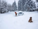
Jason Arbetter of Bend shovels out a spot for a car that got stuck trying to travel down First Street on February 25, 2019.
Courtesy of Jim Winkle
“I’ve seen more people cross-country skiing and snowshoeing down the street today than I’ve seen cars. In fact, the one car that tried to make it down the street, is stuck,” he said with a chuckle, still wielding the shovel he'd used to help dig it out.
Along Bend streets, happy skiers and sledders took over the scene.
Near First Street Rapids, 3-year-old Camila Baughman enjoyed her first big snowstorm with her parents, carrying a shovel and pail. She squealed with delight as her dad lifted her in and out of the snow, then she got to work burying her mom's legs in the fresh powder.
But after awhile, Camila had enough of 22 degrees.
“You ready to go home?” asked her mom, Kendra Jimenez-Baughman.
“Yeah. I want to watch TV,” Camila replied.

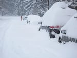
Cars on a residential street in Bend were socked in by snow on February 25, 2019.
Courtesy of Jim Winkle
On the west side of the mountains, Eugene’s snowfall flirted with breaking the record amount set in 1917, when 10.1 inches fell in a single day. On Monday, the NWS recorded 8.5 inches falling between midnight and noon, on top of about 2.5 inches already on the ground.
"The precipitation looks to be dying down," said Portland NWS meteorologist David Bishop. He urged people traveling to use Trip Check for travel info, because the western side of the Cascades and Willamette Valley are forecast to get a mixture of snow and rain showers for the rest of the week.
“During daylight hours, it will be more rain than snow ... it will refreeze [at night],” he said. “Just be vigilant.”
