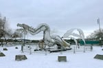
At 7:35 Thursday morning, forecasters with the National Weather Service went on social media with a question: what have you seen so far for ice and snow this morning?
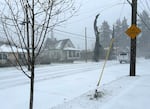
Replies and photos poured in from across the state. A woman in Blodgett, Oregon – located in the coast range west of Corvallis – wrote in: “About 650′ elevation, sleet hitting the windows woke me up at 5am, it is still currently snowing,” Another woman sent a picture of her snow-covered driveway in Yoder, Oregon, south of Canby. “Steadily coming down at my home,” she wrote. “Madras, at least 4 inches and still falling heavy,” another person chimed in.

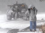
A man who gave his name as Robin videos the snowfall as he walks to work in Beaverton, Ore., Feb. 13, 2025. A Guatemala native, he says he has lived in the Portland area for eight months and this is his first time seeing snow.
Kristyna Wentz-Graff / OPB
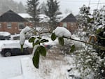
Five hours later, more than 600 people on Facebook and dozens on X had shared the snowfall at their location and elevation, often captured by a photo of a tape measure stuck in the snow.
1.5 inches, Helvetia area of Hillsboro. 500 foot elevation, 26.5 degrees currently pic.twitter.com/hUg04MM1c4
— Rod Reed go ducks (@rodreed62) February 13, 2025
It was a windfall of data for the National Weather Service. Some of it came in quickly enough to help the forecasters in the Portland office adjust their understanding of the winter storm, and the warnings they sent out.
According to Colby Neuman, a meteorologist with the National Weather Service’s Portland office, weather models are imperfect, and any inaccuracies are “magnified when we’re on the cusp of 32 degrees,” like the current storm.
A model that’s off by just a degree can seriously understate or overstate the public impact of a weather event.
Modeling is just one tool forecasters use. The National Weather Service also relies on a powerful radar, located between Linnton and Scappoose in the West Hills, to detect rain, snow and hail falling across western Oregon. But that radar has some limitations.
Due to the angle of the radar beam and the earth’s curvature, the beam climbs higher in the atmosphere as it travels further from the West Hills. As a result, by the time it reaches the Eugene area, the radar is at about 8,000 to 10,000 feet, often up above the precipitation forecasters are trying to measure.
“It’s shooting over the top of the cloud,” Neuman said. Forecasters can make inferences from the satellite images they have, but direct reports of what’s falling in a person’s backyard are particularly helpful.
“There’s nothing better than just true ground truth data of [the] reality at different people’s locations,” Neuman said.
In the case of the current storm, those early “ground truth” photos coming in from up and down the Willamette Valley showed between an inch and 2.5 inches of snow falling between Eugene and Salem, which led the weather service to increase their snow forecast for the Portland Metro area and Southwest Washington as well.
So far, the storm has produced less freezing rain and more snow than expected, Neuman said.
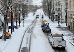
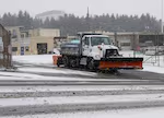
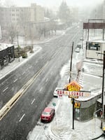
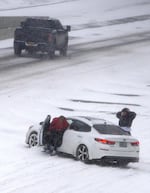
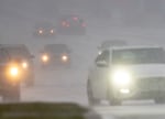
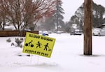
The snow is still causing major impacts to transportation, including a more than 100-car pile-up on Interstate 84. But the smaller amount of freezing rain means less impact from downed trees and power outages.
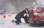
For those who want to contribute to the snow measurement effort, NWS officials said the best photos include a tape measure or ruler showing the depth of the snow on a hard surface, like a table, chair, or car top. People should also report the time they took the photo, their town or neighborhood, and their elevation – if known.
Photos that meet those standards can get entered into an official database and contribute to a national snow analysis, created by the National Operational Hydrologic Remote Sensing Center.
The storm isn’t over yet. After a break of a couple of hours, a second wave of precipitation is expected later Thursday. That could fall as freezing rain, or snow.