In this photo provided by InciWeb, a plane drops retardant on the Durkee Fire on Sunday, July 21, 2024.
Dan Martin, NW Team 6 via InciWeb
Dear Reader,
For more than 100 years, OPB has offered reliable news and connection. Through wildfires, elections and economic downturns, OPB has been there to inform and connect our communities. Today, journalism faces new obstacles.
But this work is only possible because of people like you — readers who turn to articles like this and continue to engage with independent journalism in our community. If OPB has been a part of your life, if it has helped you see your community or the world more clearly, please consider making a contribution today.
— The OPB Team
Please select an amount to give. Your contribution ensures that fact-based reporting, cultural connection, and stories that strengthen our community remain freely available to everyone.
An Eastern Oregon wildfire has spurred authorities to issue evacuation orders for a small town in Baker County.
Caused by a July 17 lightning strike, the uncontained Durkee Fire has already consumed more than 220,000 acres in Malheur and Baker counties as of Monday. Strong winds, dry conditions and more thunderstorms in the forecast led sheriff’s offices in the two counties to evacuate the Rye Valley community and the city of Huntington, a town of 500 people in southern Baker County.
The fire is about nine miles north of Vale, a city of 1,900 and the seat of the Malheur County government. While evacuation orders remain in effect for Huntington, authorities are not expanding them at this time. A Huntington city official told the Baker City Herald that some residents were transported to an evacuation shelter in Ontario, about 30 miles south.
Jessica Reed, a public information officer for the incident command team assigned to the fire, said there are already 565 firefighting personnel assigned to the fire with plans to request more resources.
“Obviously, the Pacific Northwest has fires all over … so resources are spread thin,” she said.
Reed said the incident command team is aware that weather conditions remain unfavorable and that they will continue to fight the fire with aerial operations, primarily attacking growth in the fire’s northwest section. She urged residents under evacuation orders to follow instructions and leave the area.
The explosive growth of fires over the weekend underscored a dramatic turn in Oregon’s fire season, which started slow with rainy spring weather but rapidly worsened with an early July heat wave. As of Monday afternoon, four fires were burning more than 100,000 acres each, with the Durkee Fire the largest of that group.

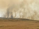
In this photo provided by InciWeb, the Durkee Fire is seen from Huntington Road in Eastern Oregon on Sunday, July 21, 2024.
Lauren Bond via InciWeb
Vicki Moles, a spokesperson for the Oregon Department of Transportation, said smoke from multiple wildfires continues to be a challenge in Eastern Oregon. On Monday, visibility degraded to the point that transportation officials closed Interstate 84 between Baker City and Ontario. The highway reopened the same day. By Monday evening, ODOT announced it would be closing I-84 between Pendleton and Ontario nightly from 7 p.m. to 5 a.m. That closure is expected at least each night through Wednesday, but could last through Friday.
“I understand they’re expecting volatile fire behavior during the next few days,” Moles told OPB. “There’s a lot going on and, fortunately, we do have a lot of crews and staff spread out and keeping an eye on things.”
While flames from the Durkee Fire have not reached I-84 yet, it’s possible westerly winds could push it farther and cause it to jump to the east side of the highway. ODOT urged drivers to delay trips or find alternate routes as the rolling closures unfold.
Highway 395 between Ukiah and Long Creek remains closed as a result of several wildfires burning in the area. Moles said ODOT crews have noted debris and expect the highway to be closed for at least another day or two.
“The fire is really close to the highway there,” Moles said. “And so there’s trees that are on fire that have fallen on the highway.”
Moles said travelers should follow the common refrain used during snowy winter months: “Know before you go.” She suggested people plan their routes and look for closures using TripCheck before heading out. ODOT also recommends travelers carry food and water with them, and avoid service or forest roads as detours around closures.
While temperatures in the region are expected to drop as the week progresses, the weather may not work in firefighters’ favor.
Several weeks of above average temperatures combined with a lack of moisture dried out vegetation in the region’s mountain environments, said Brandon Lawhorn, lead forecaster for the National Weather Service’s Pendleton office.
Lawhorn said last week’s thunderstorms did provide a significant amount of rain in some areas, but it wasn’t nearly enough to alleviate fire conditions and not every area hit by lightning received rain.
“Lightning can strike from outside the storm core,” he said.
While Lawhorn said the federal government’s forecasts show the temperature falling slightly during the back half of the week, more thunderstorms are expected in the forecast.


