What’s happening
High temperatures are in the forecast along the Interstate 5 corridor, the Willamette Valley and in central and eastern Oregon. More than a quarter million acres across multiple counties in eastern Oregon are ablaze with wildfires, and that could mean smoke and haze, especially in central and northeastern Oregon.

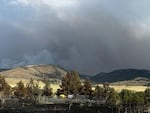
A view of the southern portion of the Lone Rock Fire in north-central Oregon on Wednesday, July 17, 2024.
Courtesy InciWeb
Hot weather persists
The National Weather Service is anticipating a hot weekend across much of Oregon and southwest Washington. The agency on Friday issued a heat advisory along the Interstate 5 corridor from Battle Ground, Washington to Cottage Grove, Oregon from 11 a.m. to 11 p.m. Saturday. Temperatures could reach the mid-90s.
From central Oregon east towards Burns a heat advisory is in place from 11 a.m. Saturday to 11 p.m. Monday. Harney County could see temperatures over 100 degrees over the weekend.
From The Dalles to the Idaho border, much of northeastern Oregon will be under an excessive heat warning, the NWS’ highest warning for hot temperatures, from 11 a.m. Saturday to 10 p.m. Monday.
Widespread haze is also expected in northeastern Oregon, with a fire watch through the weekend as well. Within the footprint of the excessive heat warning are the Lone Rock and Cow Valley fires.
Crews battle multiple fires
Heat and extremely dry conditions have created tinderbox conditions east of the Oregon Cascades, where human actions have contributed to the start of the Larch Creek, Cow Valley and Falls fires. The Bureau of Land Management is offering a reward for information about the human causes of the Cow Valley and other smaller fires in the Malheur Reservoir area. Hundreds of people were at work battling multiple blazes Friday morning. They gained ground in some areas, while wildfires elsewhere continued to grow.
Search and rescue crews went door to door in Ukiah, a community of fewer than 200 people in eastern Oregon, Thursday night warning people of potential evacuations from the Battle Mountain Complex, according to the Umatilla County Sheriff’s Office. On Friday afternoon, the evacuation level for Ukiah was at “Level 2 - Be Set,” meaning residents could stay in their homes but were told to move out of the area fast if conditions worsened. A new “Level 3 - Go Now” order was in place to the south of Ukiah, and included a portion of Highway 395.

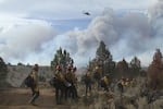
A ground crew of firefighters walk to the fire line of the Falls Fire, located northwest of Burns, Oregon, on Wednesday, July 17, 2024. Overhead, a helicopter flies above the fire.
Mike McMillan for the U.S. Forest Service / InciWeb
But further south in Harney County, heavy smoke helped keep temperatures down, allowing crews to establish control lines and minimize the growth of the Falls Fire. Firefighters from California have joined containment and mop-up efforts there.
Mandatory evacuations have been lifted from Harney County’s Cow Valley Fire and Wasco County’s Larch Creek Fire, and the mop-up of the Salt Creek Fire in Jackson County has been handed back to local crews.
Fires by the numbers
Most recent estimates as of 2:30 p.m. Friday:
- Lone Rock Fire, Morrow County — 83,922, 40% contained.
- Falls Fire, Harney County — 114,238 acres, 10% contained, 11 homes destroyed and more than 2,000 homes at risk
- Cow Valley Fire, Harney County — 133,408 acres, 77% contained.
- Larch Creek Fire, Wasco County — 18,286 acres, 65% contained.
Why it matters
Since early July, temperatures across much of the Northwest have been hotter than the norm. It’s part of a broader trend Oregon’s state climatologist has attributed to climate change. That’s dried out areas that had finally emerged from drought and created prime conditions for wildfires.
Resources:
- How to tighten up your emergency plan
- How to prepare for wildfire smoke
- Air quality updates from the Oregon Smoke Information blog
- Updates in Spanish at Oregonhumo.org