Oregon has a new draft map illustrating which areas are most susceptible to wildfires.
Oregon State University and the Oregon Department of Forestry released the proposed wildfire hazard map Thursday morning. There, Oregonians can look up specific tax lots to see how susceptible they are to wildfires.
Related: View the interactive wildfire hazard map here
This is Oregon’s second attempt at creating a wildfire map. State fire officials and OSU first released a map in 2022 under a tight one-year deadline set by Senate Bill 762. That first iteration received intense public backlash, particularly from property owners concerned it would affect their homeowners insurance. The state ultimately rescinded it.
This time, officials spent more time on public outreach, meeting with hundreds of Oregonians in cities and towns around the state. Oregon Department of Forestry spokesperson Derek Gasperini said those meetings and other public comments played a big role in launching this new map.
“We’re trying to not alarm folks and make sure that they have an opportunity to see it before it impacts them in any way,” Gasperini said.
While the public has until Aug. 18 to comment on this new map, Gasperini said people should contact his department with feedback any time. The best way to comment is by emailing hazardmap@odf.oregon.gov.
This new map doesn’t look much different than the previous version. It has a new name: This time it’s called a wildfire hazard map, instead of a wildfire risk map. There are also fewer wildfire hazard levels that properties can fall into. There are now three levels instead of five: low, moderate and high.

Oregon released a preliminary wildfire hazard map the morning of Thursday, July 18, 2024. The state will take public input before approving a final map. Left: The map groups land across the state into three wildfire hazard levels: low, moderate or high. Only high-risk properties that are also in the wildland-urban interface could face new building code and landscaping regulations. Right: This view of the map highlights areas that fall into the wildland-urban interface, usually sparsely populated areas just outside of cities.
Maps courtesy of the Oregon State University College of Forestry and the Oregon Department of Forestry
Similar to the initial version, this new wildfire map won’t impact homeowners insurance plans. State law prohibits insurance providers from using it to determine premiums or coverage. Most insurers already have their own maps and databases to make those determinations.
The new map also lowers wildfire risk for many hay and pasture lands, since those areas are usually irrigated or grazed much of the summer. Farmers and agriculture advocates are pushing for dropping still more irrigated farmlands from the high hazard level before the map is made official.
There’s little data or research on irrigated farmland and wildfire risk. Still, researchers say flames tend to avoid those moist regions.
“It’s pretty obvious that often, maybe even most of the time, those irrigated croplands do serve as a pretty functional fire break because the fuels are wet and not burnable,” Oregon State University College of Forestry assistance researcher Andy McEvoy said.

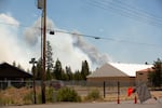
FILE - The Darlene 3 Fire burns on the eastern edge of La Pine, Ore., on Jun. 26, 2024. A new map shows the vulnerability to wildfire of specific Oregon tax lots.
Kathryn Styer Martínez / OPB
Still, it’s not clear how state officials will account for farmlands that stop getting irrigated in the middle of a wildfire season — which occasionally happens in Oregon’s most drought-prone areas. The state is considering rules that would lower wildfire hazard levels for croplands that were irrigated one out of the last five years. Public hearings for that change are scheduled for July 31 and Aug. 1.
Like the previous map, the new wildfire hazard map illustrates which properties fall into a wildland-urban interface, which are sparsely populated areas where cities transition into wildlands. The wildland-urban interface covers less than 5% of the state, according to OSU researchers.
McEvoy has been part of the wildfire map-making process since it first began in 2021. He says the wildfire hazard map serves three major purposes: to educate the public about their wildfire exposure, to help lawmakers prioritize fire adaptation and mitigation resources in the most vulnerable areas, and to identify which areas will need to implement new building and landscaping regulations.
Only properties that fall into high-hazard zones in the wildland urban interface will have to follow those new building and landscaping regulations. They could require new buildings and building additions to be built with fire-resistant materials, like metal roofs or cement siding. They could also require properties in those areas to maintain a “defensible space” — like by removing lower branches from tall trees, spacing trees far from power lines and storing lumber far from buildings.
Once the map is finalized in October, the state’s Building Code Division will begin its administrative process for creating new building codes, and the Oregon State Fire Marshal will begin creating rules for defensible space. Both processes will have opportunities for public comment.
Editor’s note: This story was updated to add an image of Oregon’s new wildfire hazard map when it was officially released at 8 a.m. Thursday.
Correction: This story has been updated. The email address to submit comments on Oregon’s new wildfire hazard map is hazardmap@odf.oregon.gov. The state originally supplied an incorrect email address.
