An atmospheric river event is bringing much-needed rainfall and warmer temperatures to the Pacific Northwest, but that also means less snowfall in the Cascade Range.
On Monday, the National Weather Service said the atmospheric river, a narrow ribbon of moisture coming up from the tropical south, could bring between 7 to 10 inches of rain along the coast. Meanwhile, the Willamette Valley could see up to 3 inches of rain in a span of three days.

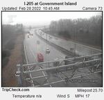
Forecasters issued a flood watch Monday, Feb. 28, 2022, for parts of northwest Oregon and southwest Washington until 1p.m. A so-called atmospheric river brought moisture and wind gusts from the Pacific Ocean inland throughout the Pacific Northwest. The heavy snow and rain could mean flooding in low-lying areas and small streams as well as avalanches in the mountains.
OPB / Oregon Department of Transportation
According to the weather service, that’s more rainfall than the area saw between Jan. 10 and Feb. 25, when only 1.65 inches of rain was measured at the Portland International Airport. Those seven weeks were the driest ever recorded since recordkeeping began in the 1940s.
“Over the last 24 hours, a large portion of the area from Salem northward up through Portland and Vancouver has had between an inch and a half and 2 inches of rain,” National Weather Service Meteorologist Colby Neuman said.
But Neuman said atmospheric rivers bring warmer temperatures and could melt away the current snowpack.
“Basically, all of this precipitation is falling as rain below 6 or 7,000 feet,” he said, “and so it’s not actually really adding any snowpack.”
Strong winds and heavy rain prompted Mount Hood Meadows, Timberline Lodge and Summit Pass to close their skiing and snowboarding operations on Monday with plans to reopen as soon as conditions improve.
The weather service forecasts a weaker storm system toward the end of the week, and Neuman said that could be an indication of a much cooler and wetter March.
