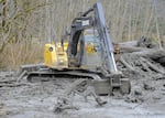
An excavator working in the debris field near Oso, Washington, where a landslide killed 43 people in 2014.
WSP
Rain is expected to fall on Oregon’s wildfires Thursday night. After battling several record-setting fires for 10 days, firefighters desperately need the flame- and ember-quenching moisture.
But there’s a chance those rains could bring another set of consequences: violent, fast-moving landslides called post-fire debris flows that can outpace cars and annihilate anything in their path.
The National Weather Service put out an alert for flash flooding and potential debris flows for burned areas throughout the Oregon Cascades. But even though the debris flows that follow fires are well-studied, there’s never really been one documented in western Oregon.
The Oregon Department of Transportation, fire officials and researchers all agree on this: They really can’t say if a debris flow will happen, or if it does, how big it will be.
Related: Incoming rain could improve air quality in Oregon
But they also say that these fires created the perfect conditions for such events. They burned very hot, in very steep terrain.
“It’s worse than I feared. It really is,” said Michael Zimmerman, senior engineering geologist for the Oregon Department of Transportation. He works in an ODOT-designated region that encompasses Portland, Mount Hood and the area burned by the Riverside Fire.
Zimmerman spent most of the last two days driving Highway 224, which cuts through the heart of the Riverside Fire scar in Clackamas County. He was surveying areas that looked unstable and likely to slide.
“From what I’ve seen the past two days, the understory just … burned off. Any vegetation that was holding loose rock and soil in place is just gone,” Zimmerman said.
Right now, bits of soil and rock ranging from microscopic to massive are tumbling down the bare mountainsides around the Riverside Fire. This movement, which happens without rain, is called “dry ravel.” It’s a big post-fire threat: falling debris is the top cause of injury for firefighters.
“I saw boulders the size of cars in the road,” Zimmerman recalled. And those boulders are just the start. “Drainages are going to fill up with the material that’s just rattling down now.” The U.S. Geological Survey says this ravel can fill up drainages in just a few days. Sometimes, in a few hours.
As the water courses down the mountains, it could flood those same drainages, picking up the tiny particles, rocks and boulders that settled there after the fire.
“And then the water could just send down massive debris flows. That’s a high-speed landslide. It’s dangerous to anyone who gets caught in it,” Zimmerman said.

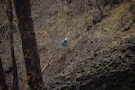
A crew member works on a section of the Pacific Crest Trail damaged in the Eagle Creek Fire.
U.S. Forest Service
These flows — which fires can also make worse — happen when the amount of rain coming down is more than the soil can absorb. Water courses along the surface of the mountainside and through drainage basins, less like a traditional Oregon landslide and more like a flash flood in the desert.
While no one is really sure what a debris flow would look like in the Oregon Cascades — or if one is even possible in the forests that were burned — researchers do know a lot about the different factors that could cause, or stop, one of these destructive landslides.
Stripped mountains, steep canyons
The fires that burned in the Oregon Cascades and razed buildings in their path began in dense forests high up in the mountains. The understory is thick with vegetation, full of ferns and bushes, and young trees of all sizes. Douglas firs dominated the mix of conifer trees that towered above, blocking out the sun.
Related: After wildfires, Oregon faces higher risk of landslides
It takes a lot for Douglas firs to catch on fire. They’re basically wooden water towers, rising well over a hundred feet above the forest floor. But by September, the understory is tinder-dry. So that burns first, and then heat builds beneath the canopy until the trees explode in flame. It’s called “torching.”
A lot of trees torched during these fires. Scott Owens is a public information officer for the Beachie Creek Fire, which burned more than 190,000 acres through and around the Santiam Canyon east of Salem as of Thursday. He said the fire burned at different intensities in a mosaic across the area.
“Some of the areas burned very, very hot,” he said. Some, less so.
Trees in a forest catch the rain as it falls, but fires strip trees of their branches and foliage. They’re like an umbrella with the cloth blown off. So when rain falls in a burned area, a lot more of it reaches the ground.
Trees also keep forests dry in another way: They act as pipes, moving water from below the surface up toward the treetops, where it evaporates. Dead trees do not absorb water.
"Anything to slow the water down helps, even a little bit,” said Josh Roering, a geologist at the University of Oregon. Roering studies the impacts of fires on landslides.
He said the trees themselves do a lot to minimize landslide risks, but the same is true for understory vegetation. Without it, slopes are much more unstable, and water can flow unimpeded, picking up freed rock as it tumbles. It’s not a good combination.
Soaks up water like a rock
In 2017 after fires tore through communities around Santa Barbara, California, waist-high mudflows, moving at almost 40 miles per hour, killed 17 people and flattened structures that the fires had spared. But California’s ecosystems are radically different from Oregon’s. The fires in Santa Barbara burned through vast expanses of chaparral, scrub and brush freckled with small stands of pine and oak. When those fires burn, they burn hot and cause chemical changes in the soil. It creates the perfect conditions for something called “fire-induced water-repellent soils” or “hydrophobic” soils.
“You sprinkle water on it, and it just forms these little droplets that sit on the surface,” Roering explained. In California, summer fires are often followed by massive “pineapple express” storms, which form rivers in the sky. These atmospheric rivers dump rain onto the scorched hillsides, and the soil never has a chance to absorb it. Water rushes down the slopes, creating cement-like flows of mud, rock and debris.
Because the conditions in Oregon are so different from those in California, Roering isn’t exactly sure how everything will play out. There are two factors that influence fire-induced, water-repellent soil formation: the temperature of the fire and the types of fuel it was burning.
“There is a vegetation dependency, and in our case, that’s a big question mark,” Roering said. “The ecosystems are so different.”
Some research has suggested that fires in Oregon’s lodgepole pine forests create thicker layers of non-absorbent soil than similar fires in lodgepole pine forests in Colorado. In the study, authors hypothesized that this happened because there was so much more fuel.
“Piney trees make a lot of those resins that volatilize and create a hydrophobic layer,” Roering explained. They leave thick deposits of pine needles across the forest floor, which can ignite. And they’re full of pitch and resin.
“Doug firs are our dominant species out here. We really need to investigate it more to find out the effects [of fire on the soil],” Roering said, “But we need to find out. Because the sites in Oregon where we’ve documented extreme hydrophobicity were Douglas fir dominated.”
Owens, the Beachie Creek Fire spokesperson, said that in many areas, Oregon’s fires certainly burned hot enough to create such a non-absorbent, hydrophobic layer, but other areas might have been spared. It will take time before geologists can enter the area, sprinkle water on the ground, and find out what areas could be safe.
But soils dried out by weeks of hot, rainless conditions can be “a real recipe for disaster, too,” said Alison Duvall, a landslide geologist at the University of Washington. “Water doesn’t infiltrate very dry soils very easily. And that can also cause a lot of slides.”
As soil dries, the sediment settles. It packs into tiny cracks, creating a crusty layer on the top. It’s not quite the same as the water-repelling layers created by fire, but it’s not very absorbent.
But Roering hopes that potential debris flows in Oregon won’t get as bad as they do in California, because Oregon has something California doesn’t: lots of trees, which could break up those layers of soils that have been rendered non-absorbent by fires and drought.
”The layers are punctured by tree roots," Roering said. Those roots could create channels and tunnels where water can soak deep into the soil, stopping flash flooding and debris flows.
It’s basically a race, Roering said, “between the soil disturbance from trees and burns, and the natural drying and settling that occurs in forests.”
And with so few examples of big fires in western Oregon to learn from, he has no idea who will win that race.
A tale of three fires
The 2017 Milli Fire offers a rare example of a post-fire debris flow in western Oregon — but barely, given that it occurred at the crest of the Cascades, Roering said.
It torched McKenzie Pass along Highway 242. A thunderstorm brought torrential rains to the burn scar the next spring. When the flood started, it moved quickly, trapping one unsuspecting motorist and his BMW. The driver was not hurt and the car was the only thing damaged.
“That was lucky. There’s basically nothing up there,” Roering said. He and a graduate student visited the area afterward to study the slide. It was remarkable.
“A whole winter of rain and snow didn’t wash the hydrophobic layer away, but then the storm came,” he said.

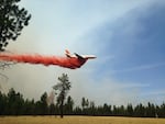
A heavy air tanker flies over the Milli Fire in the Three Sisters Wilderness in Central Oregon.
Central Oregon Interagency Dispatch Center
But the conditions on the top of McKenzie Pass are vastly different than those in lower elevations. The soil is ashy, the trees are different, there’s less underbrush.
Roering has studied other fires that left behind the kind of hydrophobic soils that could be present after Oregon’s recent, massive fires. One study area in the Oregon Coast Range had thick, dense patches of extremely non-absorbent soil. But the other patches of soil were absorbent enough, Roering said, that “when it rained, the water found enough places to soak in.”
And another such area was the burn left by the 2017 Eagle Creek Fire in the Columbia River Gorge. Despite National Weather Service warnings, flash floods and mud flows were small.
Thursday’s weather service warnings could well lead to similar non-events when it comes to after-fire debris flows — or not, Roering said.
Given all the landslide uncertainty, Beachie Creek Fire spokesperson Owen says fire crews are closely watching the weather. If the rain gets too heavy, they’ll leave their fire lines and be long gone before any rushing mud arrives.