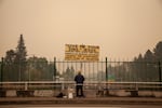
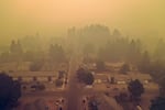
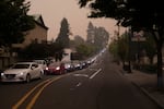
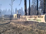
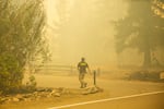
Wildfire smoke is creating some of the worst air quality in the world for Oregon cities, including Portland.
Metro area residents are noticing more smoke and evacuation notices are creeping closer to the city, as fires continue to burn through neighboring Clackamas County.
Residents of Estacada, Molalla and Colton are under Level 3 “Go Now!” evacuation advisories as of Friday evening; Oregon City, Canby, Sandy and Mount Hood are Level 2, which means they should be ready to go at a moment’s notice. Fire officials said Friday night that the Beachie Creek Fire — also known as the Santiam Fire — was responsible for four deaths, including two bodies that were found Friday, but weren’t immediately identified publicly.
Firefighters are preparing for the Beachie Creek Fire and the Riverside Fire to merge. They’ve cleared the area between the two blazes.
Multnomah County has yet to issue an evacuation order, but Portland Mayor Ted Wheeler closed all Portland parks and outdoor spaces and has declared an emergency.
In Medford, the Almeda Fire has claimed at least one life, authorities confirmed Friday. That brings the known death toll from the Oregon fires to six. The fire remained stable, though much of the city is still under a Level 3 evacuation order. The latest update Friday tallies the area burned at 3,574 acres, with 20% containment. But a few miles northeast, the Obenchain Fire expanded rapidly, and several small communities were placed under Level 3 evacuation orders.
The Holiday Farm Fire continues to burn near the Springfield/Eugene metro area. Reduced winds Thursday allowed crews to bring in heavy machinery to expand fire lines near Rainbow to the east and Springfield to the west. No new evacuation orders were issued Thursday.
All told, 900,000 acres have burned statewide, and more than 500,000 people are under some level of evacuation or pre-evacuation orders.
These online tools offer up-to-the-minute emergency information on wildfires, evacuations and air quality in the Pacific Northwest:
- Northwest fires, Oregon evacuations: Oregon’s RAPTOR Map shows wildfires across the U.S. West and evacuation zones within the state. Enter an address to quickly zoom in on a specific location. It’s slow to load, so prepare for a brief wait before the map appears.
- Major Oregon and Washington fires: The Northwest Interagency Coordination Center, which coordinates firefighters across the region, shares this map of major fires in the Pacific Northwest
- Air Quality Index: Enter a zip code, town or address for the latest local air quality readings.
- BlueSky Canada has an interactive map showing wildfire smoke forecasts across the Pacific Northwest, including Oregon and Washington.
- Here are some practical tips — including a packing list — on how to prepare for a wildfire evacuation.
- PublicAlerts.org provides links to sign up for emergency phone and email alerts across the Portland-Vancouver metro area. Scroll to find your local jurisdiction.
- Outside the greater Portland metro area, alerts are handled by local governments. Search “Emergency Alerts” and your county’s name to find a link.
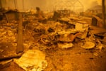
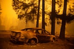
The remains of a home destroyed in the Santiam Fire near Gates, Ore., Sept. 9, 2020. Fires around Oregon could become the deadliest, costliest in state history.
Bradley W. Parks / OPB
Clackamas County fires grow despite improving weather
Fire officials overseeing the Riverside Fire in Clackamas County said that, while more resources are available and the weather has improved, they are still fighting a very active fire with persistent danger.
According to an update on the National Wildfire Coordinating Group, erratic winds Thursday drove growth on all sides of the fire, which was estimated to be more than 130,000 acres on Friday afternoon. But winds in the area were considerably lighter Friday and humidity had increased. Fears that the Riverside and Beachie Creek fires would merge had yet to materialize.
“As of the most current infrared flight that we have, it still shows the Beachie Creek and Riverside fires, respectively, approximately one air mile apart,” said Holly Crake, the public information officer for the Riverside Fire incident management team. “It’s a very fluid and dynamic situation. We anticipate with a combination of weather and continued record dry fuel — timber and grass out there — that it’s likely the two might merge in the coming hours or potentially days.”
Related: Weather is improving, but Clackamas County fires still grow
Doug Grafe, fire chief at the Oregon Department of Forestry, said Friday that improving weather conditions will allow firefighters “to move from just life safety to offense against these fires.”
Oregon Gov. Kate Brown, meanwhile, warned there’s still a long way to go in fighting fires tearing through the state and that many won’t be extinguished until fall rains arrive.
Related: Improving weather conditions put Oregon firefighters on ‘offense’
Law enforcement dispel antifa rumors
As fires ravage Oregon and Washington, burning around 1 million acres in a matter of days, fear and rumors have begun to take hold on social media.
Law enforcement officials who spoke to OPB, however, said they have seen no evidence of antifa or any other vigilante groups starting fires. Officers with the Douglas, Clackamas and Jackson county sheriff’s offices have all tried to squash the rumors this week, saying people calling with misinformation are wasting resources needed to help with firefighting and relief efforts.
The FBI also issued a statement Friday, saying it had not found any rumors around extremist groups starting wildfires to be true. Police and fire officials say they will investigate the causes of all the fires the state faces after conditions are more stable and life and property are protected. For now, those officials are clear: There’s no evidence antifa or any other political group is committing arson at this time, and online speculation wastes precious resources needed to save lives.
Related: Law enforcement: Untrue antifa rumors waste precious resources for Oregon fires
Federal emergency aid for Oregon
Late Thursday, President Donald Trump declared a federal emergency for Oregon, something Gov. Kate Brown and all seven members of the state’s congressional delegation had requested. The declaration will make it easier for federal agencies to coordinate with state and local officials and for Oregon to receive federal money to aid in recovery.
Once the emergency declaration is signed, Oregon officials will need to compile a report on the devastation caused by this week’s fires in pursuit of a major disaster declaration.
U.S. Sen. Jeff Merkley said that second designation will bring “significant financial assistance,” and he believes Oregon should easily qualify.
Related: Trump declares Oregon emergency, federal relief might be package deal for Western states
How to be ready before officials issue that ‘Get Ready’ evacuation notice
Thousands of people across Oregon have been forced to evacuate this week as wildfires burned across hundreds of thousands of acres of land. Often there was little time between the Level 1, or “Get Ready,” notification, and Level 3, or “Go Now.”
That forced many people to make split-second decisions about what to bring, what to leave and where to go.
Making those decisions about what to do in an active evacuation scenario is almost impossibly difficult — even for those of us who cover wildfires and other natural disasters for a living.
This week’s fires are a reminder that very few of us are immune from the risk of wildfire in Oregon, even in a major city.
Here’s what you can do to prepare before you get an evacuation order or experience a disaster.
Related: How to tighten up your emergency plan
After fires burn Oregon hillsides, another risk awaits: landslides
Right now, a bit of rain would be widely celebrated as wildfires rage across the state. But when big rain storms hit this fall, they’ll bring a much higher risk of landslides because of all the steep slopes that burned.
Wildfires wipe out the trees and plants that help keep soil, rocks and water from running down slopes and wreaking havoc as they go, according to Portland State University geology professor Scott Burns.
“With wildfires, the risk of landslides goes significantly up,” he said. “This is a real big potential problem. Without trees and vegetation you definitely have an increased chance of slope instability.”
Related: After wildfires, Oregon faces higher risk of landslides
900,000 acres and counting: Gov. Kate Brown acknowledges ‘bleak’ situation
About 3,000 firefighters are currently battling the flames scorching Oregon — which have devoured 900,00 acres and prompted as many as 40,000 people to evacuate — but in order to get the fires contained, officials warn they need double the humanpower.
Oregon Gov. Kate Brown has requested help from other states — Utah strike teams are on their way — and she’s asked the U.S. Department of Defense for a battalion of trained firefighters to assist.
“We have never seen this amount of uncontained fire across the state,” the governor said in a press briefing on Thursday.
The governor said she knows the “situation is bleak right now,” and said the state “will get through this.”
Here’s what the state’s top officials are saying about the fire situation.
Related: Gov. Brown: Oregon has never seen so much uncontained fire at once
Wildfires, smoke force schools to cancel classes, activities
School districts around Oregon and Washington are dealing with the impacts of wildfires on the start of a school year already destabilized by the COVID-19 pandemic.
Several districts have delayed the start of the school year or canceled school this week.
Salem-Keizer schools will start for students in grades K-12 Wednesday, with time to meet with a teacher and classmates. Instruction will begin Thursday.
“While we focus on everyone’s safety, we are making changes to next week’s back-to-school schedule,” said Superintendent Christy Perry in a statement.
Springfield and Eugene 4j have both delayed the beginning of the school year, starting Sept. 21 instead of Sept. 14.
More on fire-related school impacts, check here.
Related: Wildfires impacts on school: Meal and technology distribution cancelled, first day of school delayed
Fire impacts felt in Portland
Although Multnomah County wasn’t under any evacuation orders late Thursday, Mayor Ted Wheeler declared a citywide emergency and officials with the Metro regional government and Clackamas County announced they were working to set up the Oregon Convention Center as a shelter for people forced from wildfires.
Metro said the center would accommodate up to “400 people with lodging, shower facilities and parking.” But the message didn’t say how soon it would open.
As wildfires get closer to Portland, residents are being advised to keep an eye out for evacuation advisories.
Smoke-filled air and the unpredictability of fire led to cancellations of major events: The Portland Thorns’ Saturday game against the OL Reign has been postponed until Sept. 15. The Oregon Zoo will be closed Friday.
And the Oregon and Washington transportation departments are postponing a planned closure of the northbound span of the Interstate Bridge. It had been scheduled for Sept. 12-20.
Related: Multnomah County residents advised to monitor nearby wildfire evacuation advisories
Southern Oregon update
Authorities confirmed Friday that at least one person has been killed by the Almeda Fire and around 50 people were still missing.
The fire did not grow Friday. It had burned 3,574 acres and was 20% contained, with full containment expected by Saturday.
The fire was pushed by high winds from Ashland, through Talent, Phoenix toward Medford. Evacuations were still in effect and officials report more than 42,000 people have been affected in some way by the fire. Estimates of structural destruction remain at 600 homes and 100 businesses.
The Two Four Two Fire northwest of Chiloquin is 5% contained with a footprint of 12,640 acres, according to the latest update Friday. Officials say fire activity increased overnight on the northwest side of the fire, but crews were able to limit the growth. In a morning briefing, an official indicated that fire lines have been successfully established around much of the fire, but work will continue to ensure the lines are holding and any spot fires are extinguished.
Officials say 35 structures have been destroyed and another 70 damaged. Some scattered communities in the area remain under evacuation notice. The fire started Monday evening.
The South Obenchain Fire made a major push toward Butte Falls on Thursday prompting a Level 3 “Go Now!” evacuation of the entire town of about 500 people. Shady Cove and Trail were also under full evacuation.
Air suppression efforts were hampered by poor visibility. But officials say the fire line on the southwest side of the fire (toward Eagle Point) is holding. They’re predicting some short term changes in the weather for the better. The fire perimeter is 23,150 acres. It’s still considered 0% contained as of Friday.
Mandatory evacuation orders remain in effect for the Slater Fire burning on both sides of the California-Oregon border in the Klamath National Forest. The footprint of the fire is now more than 140,000 acres, with the southern part of the fire flanking just to the north of Happy Camp and northern edge about 9 miles southeast of Cave Junction in Oregon.
Evacuation orders remain for Happy Camp and Seiad Valley in California. Mandatory evacuation notices are in effect for the Oregon communities of O’Brien and Takilma and some of the surrounding areas. Level 2 “Get Set” orders have been issued for Gasquet, California, and Kerby and Cave Junction, Oregon. The Slater Fire started on Monday night in Northern California before spreading into Oregon.
The Almeda Fire has not grown, according to the latest Friday update. The fire had burned 3,574 acres and was 20% contained, with full containment expected by Saturday.
The fire was pushed by high winds from Ashland, through Talent, Phoenix toward Medford. Evacuations were still in effect and officials report more than 42,000 people have been affected in some way by the fire. Estimates of structural destruction remain at 600 homes and 100 businesses.
