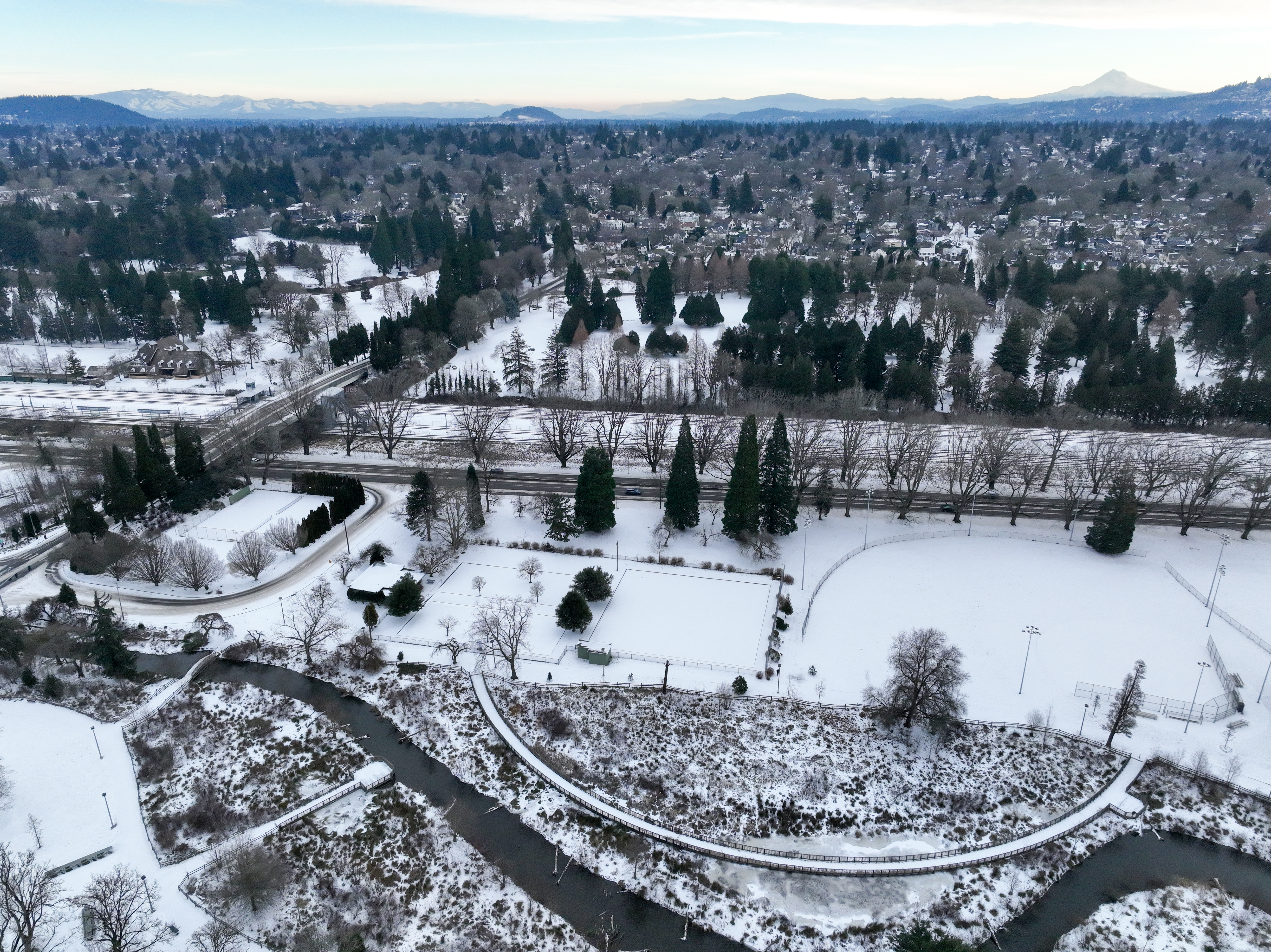
As seen by drone, an aerial view of inner Southeast Portland shows snow blanketed across the landscape the morning of Tuesday, Jan. 16, 2024. Starting Sunday, snow levels will likely drop to around 500 feet or lower in the Willamette Valley and along the central Oregon Coast.
Stephani Gordon / OPB
A mix of rain and snow is expected to hit much of the Portland metro area as snow levels dip this weekend.
Starting Sunday, snow levels will likely drop to around 500 feet or lower in the Willamette Valley and along the central Oregon Coast.
Anna Ruhl is a meteorologist with the National Weather Service. She said while there’s a chance for snow in the Portland metro area, the daytime temperatures are still too warm for it to accumulate.
“You could get snowflakes in the air and some snow might stick to cars, but nothing will stick to the roads or the sidewalks because it will melt,” she said.
Ruhl said the odds of seeing snow sticking to the ground are greater at higher elevations in Portland, like in the West Hills or Mount Scott. Areas above 500 feet may see up to 2 inches of snow.
Related: Lookback: Why winter ice and snowstorms can paralyze Portland
The rain and snow showers are likely to stick around until Tuesday. Traffic impacts will be minimal, as snow accumulations are expected to be light, slushy and short-lived. But officials are still warning drivers to be careful.
The Portland Bureau of Transportation reminds drivers to slow down and use extra caution if there’s any snow or ice on the roadways, especially in hilly areas, as overnight conditions could cause hazardous morning commutes.
TriMet officials announced Friday the agency is monitoring the weather forecast and will provide updates to its website should bus services be impacted.
The NWS also issued winter storm warnings for the northern and central Oregon Cascades as well as the northern Oregon Coast.
Heavy snow is expected to fall at elevations above 3,000 feet in the Cascades, with up to 12 inches possible through Saturday at 10 p.m.
Traveling through the passes could be difficult. Officials are asking drivers to consider postponing travel in the higher elevations until weather conditions improve.
Winter weather travelers, with the upcoming wintry weather, please prepare yourself and your vehicle for any possible hazards that might occur along your route. You can reference https://t.co/3SFImIxo7o for the most up-to-date forecast and the DOT for road conditions. #ORWX #WAWX pic.twitter.com/kAXHMeXvgy
— NWS Portland (@NWSPortland) January 31, 2025
If you must travel, Ruhl recommends bringing a bag with blankets, extra water and nonperishable food. She also suggests checking road conditions before heading out.
As for the northern Oregon Coast, the NWS said up to 6 inches of snow may fall from Friday night through Sunday morning. Drivers are also warned to take precautions as area roads will likely become slick and dangerous.