Workers place sheets of wood over windows and glass doors to protect them from the strong winds expected with the arrival of Hurricane Milton in the hotel zone of Cancun, Quintana Roo State, Mexico, on Monday. Hurricane Milton exploded in strength Monday to become a potentially catastrophic Category 5 storm bound for Florida, the second ferocious storm to hit the region in as many weeks.
Elizabeth Ruiz/AFP
Less than two weeks after Hurricane Helene slammed into Florida’s Gulf Coast and wreaked a path of destruction across the southeastern U.S., the state is bracing for another — and likely even more powerful — major hurricane to come ashore.
Hurricane Milton reached Category 5 — the strongest of the classifications — on Monday morning, with maximum sustained winds of 175 mph, the National Hurricane Center said. In its 8 p.m. ET update, the NHC said sustained winds had reached 180 mph, and the central pressure in the storm’s eye had fallen to a “near record low.” A lower pressure means a more powerful and potent storm.
“Milton poses an extremely serious threat to Florida” and is “a life-threatening situation,” the NHC said. The storm surge is predicted to be as high as 15 feet in some areas.
7pm CDT Oct 7th -- #Hurricane #Milton remains an extremely dangerous Category 5 hurricane with winds of 180 mph.
— National Hurricane Center (@NHC_Atlantic) October 8, 2024
The minimum center pressure measured by a @NOAA_HurrHunter dropsonde was estimated at 897 mb.
Latest: https://t.co/LQEVorqXZH pic.twitter.com/xT7o6vHF7r
According to hurricane historian Philip Klotzbach, only two known hurricanes have had 180+ mph winds in the Gulf of Mexico since 1950: Allen in 1980 and Rita in 2005.
The storm is expected to make landfall on Florida’s Gulf Coast late Wednesday or early Thursday.
Meanwhile, NASA has delayed the return of the four people on the Crew-8 mission who were supposed to splash down off Florida this week on a SpaceX Crew Dragon capsule. They’ve been docked at the International Space Station since March. NASA now says they won’t undock until Sunday, at the earliest, due to Hurricane Milton.
Milton’s surprisingly explosive intensification
After being upgraded from a tropical storm on Sunday, Milton underwent what forecasters called an “explosive” intensification, blowing past Category 4 strength in a matter of hours.
The National Hurricane Center had predicted earlier Monday that Milton would become a Category 5 storm, reaching maximum sustained winds of 165 mph in 12 hours before gradually weakening.

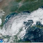
This satellite image provided by the National Oceanic and Atmospheric Administration on Monday shows Hurricane Milton churning through the Gulf of Mexico toward Florida, where it is expected to make landfall midweek.
AP
But it strengthened even faster than experts predicted, with NHC Director Michael Brennan calling its rate of intensification “extreme” in a Monday morning briefing.
The NHC says it has seen such rapid strengthening in a storm system only twice before: Wilma in 2005 and Felix in 2007.
“There are simply no words to describe the extraordinary intensification we have witnessed in this storm today,” US Stormwatch weather analyst Colin McCarthy posted on X on Monday.
The Yucatan and Florida peninsulas prepare
As of the Monday evening update, Milton was just off Mexico’s Yucatán peninsula and moving east.
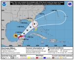
Much of the Yucatan Peninsula coast is under a hurricane warning. In contrast, hurricane watches, storm surge watches and tropical storm watches and warnings are in effect for parts of the west coast of the Florida Peninsula.
The storm is forecast to weaken slightly before it makes landfall on Wednesday, but it’s still predicted to be a “major” hurricane then. For instance, Hurricane Katrina in 2005 was a Category 5 in the Gulf but weakened to Category 3 before hitting Louisiana and Mississippi. Milton, like Katrina, will be pushing a big wall of water ahead of its arrival.
The NHC says most models agree that Milton will cross the Florida Peninsula. However, people “should not focus on the exact track” because models still disagree about landfall’s exact location and timing.
Even so, forecasters warn that it will likely be a “large and powerful hurricane at landfall in Florida, with life-threatening hazards along portions of the coastline.”
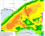
They say areas of heavy rainfall will impact portions of Florida on Monday and again on Tuesday through Wednesday night, bringing “the risk of considerable flash, urban and areal flooding” and the potential for moderate to major river flooding.
Parts of the Florida Peninsula and Keys could see 5 to 10 inches of rain through Wednesday night, with localized totals of up to 15 inches in some areas.
There is also a growing risk of life-threatening storm surge and damaging winds for parts of Florida’s west coast beginning late Tuesday or early Wednesday. Forecasters say it could raise water levels to as high as 8 to 12 feet in coastal areas of Florida, including Tampa Bay.
Speaking at a Monday morning briefing, Kevin Guthrie, the executive director of the Florida Division of Emergency Management, implored Tampa Bay residents under evacuation orders to heed them.
“I beg you, I implore you, to evacuate,” he said. “Drowning deaths due to storm surge are 100% preventable, if you leave.”
Tampa Mayor Jane Castor said on CNN that while residents may have stayed home instead of evacuating during previous storms, “There’s never been one like this. Helene was a wake-up call. This is literally catastrophic. And I can say without any dramatization whatsoever, if you choose to stay in one of those evacuation areas, you’re gonna die.”
Several Florida counties have ordered evacuations, and Florida Gov. Ron DeSantis said Monday that people should expect “a flurry of them.” State officials are urging Floridians to follow local guidance and make emergency preparations, whether they are evacuating or sheltering at home.
The state is partnering with Uber to provide Floridians free rides to and from emergency shelters, in counties that have evacuation notices in place.
“You have an opportunity today to do what you need to do to execute this plan,” DeSantis said Monday. “But time is going to start running out very, very soon.”

Early models show Hurricane Milton making landfall in Florida midweek, before exiting into the Atlantic Ocean, sparing many of the states hardest hit by Hurricane Helene.
Floridians are bracing for evacuations and impact
DeSantis has already expanded an emergency declaration to cover 51 of the state’s 67 counties and is warning people across the peninsula to prepare.
“Do not get wedded to the cone,” he posted on X on Sunday. “Floridians should prepare now for potential impacts, even if you live outside of the forecast cone.”
Guthrie, of the Florida Division of Emergency Management, said on Sunday that the state is preparing “for the largest evacuation that we have seen most likely since 2017 Hurricane Irma,” when nearly 6.8 million Floridians left their homes, resulting in statewide traffic jams.
t, a.
But he also cautioned inland residents who don’t live in an evacuation zone or depend on electricity for medical needs that “it may be better for you to just stay in place.”
Emergency officials are reminding Floridians that they may not need to evacuatefar—potentially only several miles to a higher elevation or wind-proofed shelter.
“You don’t have to evacuate hundreds of miles,” DeSantis said. “Every county has places within them that you can go to. Maybe it’s a friend’s house, maybe it’s a hotel, maybe it’s a shelter.”
A growing number of Florida counties have ordered evacuations of certain areas and home types (like recreational vehicles, mobile homes and boats), effective Monday. Those include Charlotte, Manatee, Pasco, Hillsborough and Sarasota counties, and Pinellas County, which ordered the evacuation of certain residential healthcare facilities starting Sunday.
Entities in the area, such as schools, local government facilities and the Florida Aquarium said they would be closed for several days as they prepare for Milton’s impact.
Emergency officials are urging Floridians to look up their zone, plan an evacuation route and leave as soon as they’re ordered to do so.
Guthrie also said Floridians should consider that many are still recovering from Helene: Did they use up their reserves of water, food, and pet food? Do they need to buy fresh batteries? Have they restocked their supply kits to last each family member for seven days?
“Please make sure you’re doing that today,” he said on Sunday.
DeSantis said at a Monday morning news conference that the Florida Division of Emergency Management is already fielding “hundreds of resource requests” from communities preparing for the storm, sending truckloads of food and water to central Florida and deploying more than 2,000 feet of “flood protection systems,” prioritizing critical infrastructure like hospitals and fire stations.
He also said the state is ramping up its efforts to remove outstanding debris from Helene — which would add a layer of danger and potential damage if picked up by Milton’s strong winds — calling that a “24/7 round-the-clock mission.”
Lines started forming at gas stations on Sunday as people stocked up on fuel, water and other supplies, member station WGCU reported.
WGCU notes that public school districts in many counties will be closed from Monday through at least Wednesday and that Florida Gulf Coast University — near Fort Myers — will close its campus Tuesday and Wednesday after shifting to remote operations.
The St. Pete-Clearwater International Airport has already announced the cancellation of all Allegiant Air flights on Wednesday and Thursday. NASA and SpaceX are also delaying the launch attempt of their Europa Clipper mission, which was originally scheduled for Thursday.
Milton is forecast to spare other states submerged by Helene

Hurricane Milton is expected to bring 5 to 10 inches — and in some cases, up to 15 inches — of rainfall to parts of Florida this week.
Milton is poised to strike an area recovering from Hurricane Helene’s Category 4 winds and rains.
But it is expected to exit into the Atlantic Ocean, sparing many southeastern states that Helene hit hardest, including Georgia and the Carolinas.
More than 220 people were killed by Helene, one of the deadliest hurricanes to hit the mainland U.S. since Hurricane Katrina in 2005. The Associated Press reports that about half the victims were in North Carolina, where historic flooding destroyed entire communities.
The White House assured the American people on Monday that despite the strains Helene put on the agency, FEMA was prepared to support Florida through this storm.
“FEMA has sufficient funding to both support the response to Hurricane Milton and continue to support the response to Hurricane Helene – including funding to support first responders and provide immediate assistance to disaster survivors,” the White House said in a statement.
“Today, President Biden quickly approved the Governor of Florida’s request for an emergency declaration. Under an emergency declaration, FEMA provides direct Federal support to states for life-saving activities and other emergency protective measures, such as evacuation, sheltering, and search and rescue.”
Abnormally warm water in the Gulf of Mexico, fueled by human-caused climate change, has made it easier for hurricanes to strengthen rapidly and bring even more wind and rain ashore.
Milton is the ninth hurricane to form in the 2024 Atlantic hurricane season, which runs from June through November. It’s the fifth to form since Sept. 25 alone, breaking a previous record of two during that period.
Storm researcher Philip Klotzbach said this was officially the first time three simultaneous hurricanes were recorded in the Atlantic Ocean after September. Hurricane Leslie continues to brew, while Kirk was downgraded to a post-tropical cyclone late Monday morning.
NPR’s Russell Lewis, Alana Wise and Amy Morgan contributed reporting.
