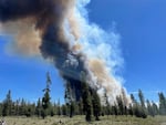
In this photo provided by the Deschutes County Sherriff's Office, smoke rises from a wildfire near La Pine, Ore., Tuesday, June 25, 2024.
Sgt. Kyle Kalambach / Deschutes County Sheriff's Office via AP
A statewide “wildfire risk map” that drew the ire of many Oregonians will return in several weeks with few changes but with a new name following a yearlong makeover.
The new “wildfire hazard map,” set to debut in mid-to-late July, will not differ in substance too much from the previous map published in 2022, according to lead researcher Chris Dunn, an Oregon State University forestry professor and wildfire expert. That first map was quickly taken offline in August 2022, just months after it was released, due to public backlash over many areas classified as high-risk. Property owners saw the map as a state attempt to regulate their properties, and it coincided with some insurers raising premiums and choosing not to renew or write new wildfire policies.
In the new “Oregon Statewide Wildfire Hazard Map,” some grass and ranch lands will no longer be considered at high-risk depending on what they’re used for and on whether, and how often, they’re irrigated. The replacement of the word “risk” with “hazard” indicates that the map is an environmental assessment, not an assessment of individual properties. There will be three hazard categories, rather than the five risk categories in the previous map.
The latest map and the public rollout is the result of broader collective efforts, unlike the last one, Dunn said.
“The Oregon Department of Forestry and OSU stood alone the last time,” Dunn said about the previous map’s public debut. “The biggest change is just that all of these other agencies have come together to participate in community meetings and to meet with the county commissions and county planners,” Dunn said.
Unraveling of the ‘risk map’
Dunn and Oregon State researchers worked with the U.S. Forest Service and the Oregon Department of Forestry in 2022 to develop the searchable “Wildfire Risk Explorer” map, which the state Legislature mandated under Senate Bill 762, a sweeping wildfire mitigation package passed in 2021. State agencies were given one year to produce a map and release it publicly.
The final map allowed anyone to plug in their address to see where their area fell among five risk categories from “no risk” to “extreme risk.”
Related: How Oregon is mapping wildfire hazards
It was meant to bring attention to the potential for wildfire across Oregon’s different landscapes, but was instead seen by many as a property-specific wildfire risk assessment. It didn’t help that for many categorized as living in an area of “high” or “extreme” risk, the map’s findings weren’t widely known until letters started arriving in the mail alerting them to their risk status.
“People would step out their backyard or their front porch and say: ‘There’s no way I’m at high risk. I’ve already cleared my property or whatever.’ Most people were making an assessment from their individual susceptibility perspective, not from an environmental exposure perspective,” Dunn said.
Assigning risk to individual properties is not what the map makers were trying to do, according to Dunn. They were looking at the landscapes around the state and using data to understand the potential exposure for wildfire across a given landscape.
But they failed to make that case. The public rollout was a disaster, Dunn said.
“There was no real hard and concerted effort to reach out to the counties and to the public, mostly because we just didn’t have the time,” Dunn said.
Also, the timing couldn’t have been worse. The rollout coincided with a sea change in the insurance industry, heavily hit by growing natural disasters and costs over the past few decades. Insurers were beginning to not renew policies or stop writing new policies in parts of California due to wildfire risk, and similar trends were beginning to show up in Oregon, on top of rapidly rising premiums. While insurers had been planning such moves for a while, according to industry experts, the public blamed the map, which was seen as an attempt by the state to regulate properties, and property owners, to make them wildfire proof.
Just a few months after being made public, it was pulled by the state forester and sent back to the drawing board.
Related: Work on wildfire risk map version 2.0 now under way in Oregon
Redoing the rollout
When rolling out the latest maps, Dunn, researchers and officials at several public agencies with a stake in mitigating wildfire are presenting a unified front, Dunn said.
Last fall, Dunn and a cadre that included officials from the State Fire Marshal’s Office, the Building Codes Division, the Department of Forestry and the Division of Financial Regulation met with county commissioners to hear their concerns.
The researchers and agencies also have held joint public meetings in parts of the state where residents were most concerned about the mapping last time, including Grants Pass, The Dalles, Medford, La Grande and Redmond. Some of the meetings have drawn hundreds of people, while others have drawn less interest. Dunn said in Redmond, about 100 people showed up and in Grants Pass, over 300 people attended. But in La Grande, staff told Dunn about 13 showed up.
Dunn said in Grants Pass, the general take was that people weren’t there to argue but to get more information.
“I think people were generally interested in learning, which is what the intent of these are,” he said.
The target for stakeholders is to get the map finished and online by mid-July. The draft map is currently with county planners across the state, who have had two months to review the data and provide feedback. Once online, the map will be open for at least a 30-day public comment period before the Oregon Board of Forestry votes to adopt it in September. The process is moving faster than Dunn and others had expected, he said, due to political pressure on the Department of Forestry.
After it’s finalized, the state officials in charge of guidelines for shoring up homes against wildfires, or home hardening, and creating defensible space around structures to make it easier to fight fires will need to get to work implementing new recommendations and rules.
Related: Meetings in ‘high hazard’ communities prepare Oregonians for revised wildfire map
The Oregon Building Codes Division is developing residential building material rules that will apply to all new dwellings and in high wildfire hazard zones that are within the wildland-urban interface. The standards would also apply to existing homes and buildings when exteriors are replaced.
“The standards are ready to adopt,” said Mark Peterson, a spokesperson for the agency, in an email. “The division is waiting on the final map, at which point we will do rulemaking to adopt the map, add it to the Oregon Design Criteria Hub, and apply the standards based on the map.”
The State Fire Marshal’s Office is also developing statewide, minimum defensible space standards that will be adopted following the finalization of the map.
Dunn said no one is going to immediately demand Oregonians start spending to wildfire proof their homes and properties.
“Their (the agencies) stance to date has always been that ‘we educate first, regulate last,’ and so I think there’s going to be a fairly substantial, multi-year gap before there’s any real, substantial regulations that occur,” Dunn said.
He’s hopeful the general attitude from the public to the newly rolled-out map will be one of curiosity rather than contempt. He said that despite the trouble with the first attempt to bring it to Oregonians in 2022, it wasn’t a total blunder.
“Even if the map failed, it put fire in people’s minds, and they’re thinking about it, and that is a difficult thing to do,” he said.
Reporting for this story was made possible with a fellowship from the nonprofit Institute for Journalism and Natural Resources.
Oregon Capital Chronicle is part of States Newsroom, a network of news bureaus supported by grants and a coalition of donors as a 501(c)(3) public charity. Oregon Capital Chronicle maintains editorial independence. Contact Editor Lynne Terry for questions: info@oregoncapitalchronicle.com. Follow Oregon Capital Chronicle on Facebook and X.