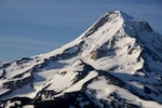
Snow lightly blankets Mount Hood in this 2009 file photo.
Vince Patton / OPB
Oregon saw quite a bit more precipitation than normal in December. But because the month was also much warmer than normal — 5 degrees above the 30-year average in some places — that precipitation meant very little snow.
The snowpack in the Cascades, as of Thursday, was less than 40% of what it should be in early January.
But heavy mountain snow should return this weekend.
Hydrologist Andy Bryant, with the National Weather Service office in Portland, said the snow coming to area ski resorts will measure in feet, rather than inches.
“Probably the overall accumulation for somewhere like Timberline or Mt. Hood Meadows is going to be somewhere between 12 and 24 inches,” Bryant said Thursday morning. “Even (Thursday) through the weekend, it’s going to be cool enough at the ski resorts to have snow. It would be anywhere from maybe 3 to 6 inches per day, but could see some heavier amounts Friday night and Saturday.”
Bryant said the snow level will drop to between 2,000 and 4,000 feet, so there will likely be snow on the mountain passes.
“People who are driving up to ski areas or driving through passes, like Highway 26 over Government Camp or Santiam Pass, you’ll want to definitely monitor road conditions and be prepared for winter travel.”
❄️ CASCADE SNOW LOVERS REJOICE!! ❄️
— NWS Portland (@NWSPortland) January 4, 2024
Expect accumulating snow above 2500 ft this weekend (Sat-Sun), including the Cascade passes where around 1 foot or more of snow is forecast.
Be prepared for winter weather conditions if traveling to the Cascades! #ORwx #WAwx pic.twitter.com/bFuVjQWZCa
Several winter weather advisories are in effect for the Cascades in Lane County and Southern Oregon from late Friday through late Saturday.
Bryant said areas below 2,000 feet will likely stay well above freezing and see steady rain through the weekend and into early next week.
After that, the region could see some gradual cooling as another weather system arrives. Bryant said by the weekend of Jan. 13, precipitation and cold temperatures could combine to bring the snow level down again. Anyone with travel plans for that weekend should keep a close eye on the forecast, he said.
As far as snowpack goes, there’s still time to get back to normal if the winter weather holds up.
“Kind of our target time for seasonal snow pack is where we end up by the month of March and in early April,” Bryant said. “Certainly there’s an opportunity to get much closer to average over these next two or three weeks. In terms of conditions at the ski resorts, definitely going to see beneficial snow over the next couple of weeks.”
