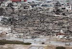
People walk near the remains of burned homes after Hurricane Sandy in the Breezy Point neighborhood of the Queens borough of New York City on Oct. 31, 2012. Over 50 homes were reportedly destroyed in a fire during the storm.
Mario Tama / Getty Images
Superstorm Sandy hit New York City on October 29, 2012 and was the deadliest storm of that hurricane season.
Over 48 hours, it damaged or destroyed nearly 800 buildings in the city, including 70,000 housing units and left about 2 million people without electricity. Forty-three people in the city died as a result and damage was estimated at $19 billion. The preparation and response was one of the largest mobilizations of public services in history, according to the city.
The consequences of a similar storm in the future could be even worse.
With rising sea levels, National Hurricane Center (NHC) modeling predicts that the extent and depth of storm surge will grow dramatically across the five boroughs. NPR's analysis found that the number of New Yorkers directly threatened by flooding could more than double from about 207,000 in 2020 to 468,000 in 2080.
Loading...
Superstorm Sandy slammed 35 public housing developments managed by the New York City Housing Administration (NYCHA), leaving tens of thousands of low-income New Yorkers without power. Other types of affordable housing were hit hard, too: about 24,000 apartments were in the path of the storm surge, according to data from New York University's Furman Center.
Claudia Perez lives in the Washington Houses in East Harlem and is president of the residents' association. She recalled watching the floodwaters surge around the local hospital.
"Sandy was really scary," she said. "When you see a hospital going underwater, you're like, 'Oh my God, what's going on here?'"

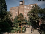
The Washington Houses is a 15-building complex operated by the New York City Housing Authority. It's just a few blocks away from the East River but was unharmed during Hurricane Sandy.
Scott Heins for WNYC/Gothamist
Future storms, coupled with sea level rise from climate change, will flood even more low-income New Yorkers' apartments, exacerbating an ongoing affordable housing crisis. NPR's analysis of NHC data predicts that a Sandy-like storm could flood more than 50 NYCHA developments by 2080.
Nationally, one study projects three times as many low-income homes at risk of frequent flooding by 2050.
"People in affordable housing are more exposed to flooding, and they have the least resources to deal with it," said Bernice Rosenzweig, a professor of environmental studies at Sarah Lawrence College.
Disasters often leave a legacy that involves a struggle to adapt with the resources left behind. In East Harlem, for example, Sandy's floodwaters damaged parts of Metro North Plaza and the East River Houses, two NYCHA developments. Both received funding from the Federal Emergency Management Agency (FEMA) for repairs and upgrades, which are still in progress.
The nearby Washington Houses were outside Sandy's main inundation zone, so it wasn't eligible for the same FEMA-funded resiliency upgrades. But the NHC data predicts that, as early as 2050, a comparable storm could bring floodwaters to the development's door, putting residents and infrastructure at risk.
Loading...
Million dollars homes built in storm surge zones
Across the East River in Brooklyn, upscale neighborhoods also are at risk. The blue door for the El Pinguino oyster bar sits on Greenpoint Avenue, a few steps from the luxury tower-studded skyline of the waterfront.
Owner Nicholas Padilla has come to dread the rain. At any given time in his dirt basement, Padilla can dig about six inches deep and hit water.

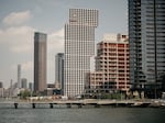
In New York City, Greenpoint and Williamsburg waterfronts have experienced a housing boom over the last decade, but little has been done to deal with future floods.
Scott Heins for WNYC/Gothamist
Padilla's first restaurant in the area, Alameda, was flooded with six feet of water and raw sewage by Sandy, costing him tens of thousands of dollars in damages, shortly after he had signed the lease. But he won't leave until the flood waters chase him permanently from his business and his home, located less than a block away. He doesn't know where else to live.
"It's New York City. It's so hard to find somewhere to go. It just feels like people will just live here until it's in the river," Padilla said.
Several parts of New York City's waterfront, including the neighborhoods of Greenpoint and Williamsburg in Brooklyn, are booming with development. The local community board estimates that 40,000 residents were added to both waterfront areas in the past decade — many in new high-rise towers right along the East River. Despite sea level rise, this property ranks among the most valuable in the city — with median sales around $1.2 million last year.
Over the next 30 years, tide and storm surges will bring damaging flooding here at a frequency that will be more than 10 times as often as it does today, according to other data from NOAA.
Advocates and environmental experts are urging the city, state and federal government to prepare its housing stock for coming storms. Some are calling for building upgrades, so New Yorkers aren't trapped in powerless, hazardous apartments and houses the next time the storms arrive. Others say the time to depart is now.
"We can't control the ocean, not even with sea walls," said Dr. Klaus Jacob, a geophysicist and climate expert at Columbia University's Climate School. "We need to start moving people to higher ground now, and using the coastal areas as a barrier."
This story was adapted from an earlier reporting project that also includes storm surge data for Miami and Washington, D.C. The full methodology for the analysis can be found there.
Copyright 2022 NPR. To see more, visit https://www.npr.org.