The now-pulled Oregon Wildfire Risk Explorer map, created by Oregon State University as part of a new wildfire policy directed by Senate Bill 762, outlined wildfire risk at the property ownership level across the state.
Oregon Wildfire Risk Explorer
The Oregon Department of Forestry will spend an extra year talking with the public about its controversial plan to create a wildfire risk map and impose rules on property owners in high fire risk areas.
The agency was overwhelmed by public outcry in June after it released a map of wildfire risk levels on every property in Oregon. Last month, after receiving thousands of public comments and 1,600 appeals from property owners, Oregon State Forester Cal Mukumoto announced his agency would withdraw the map and revise its plans to use the map as the basis for new wildfire protection rules.
Property owners complained that the map could reduce property value and increase insurance costs, and many filed appeals disputing the fire risk level assigned to their tax lots.
The forestry department is now planning to spend the next five months talking with the public about wildfire science and answering questions in community meetings before releasing a new draft wildfire risk map in March. After that, officials will spend another seven months gathering feedback and continuing to educate people about wildfire protection plans that would add requirements for property owners in high fire risk areas.
The adjusted timeline delays the release of a final wildfire risk map until October 2023 and postpones the implementation of new wildfire protection rules until the end of next year.
Related: Oregon Wildfire Risk Explorer
“A big part of our work over the next year is focused on engaging with, listening to and informing the public about wildfire risk,” Mukumoto said in a statement. “Ultimately, all of the agencies involved in this effort want to make sure Oregonians in the most at-risk communities know what they can do to better protect themselves, their families and friends, and their homes from wildfire.”
Last year, Oregon lawmakers passed a wildfire preparedness package to reduce the risk of catastrophic wildfires after the Labor Day fires destroyed thousands of homes across the state in 2020.
Senate Bill 762 calls for mapping wildfire risk on property across Oregon, developing requirements for clearing defensible space around homes in high fire risk areas and creating building codes to make structures in fire-prone areas less likely to burn. The bill’s original deadline for state agencies to finalize these wildfire protection plans was this Friday.
Doug Grafe, wildfire programs director for Gov. Kate Brown, said in a statement that there are steps Oregonians can take to keep their homes safe, and the state’s wildfire risk map will be an important tool for people to identify their individual risk.
“Most Oregonians understand wildfires are becoming more catastrophic and more frequent,” Grafe said. “We are committed to ensuring people understand what they can do to increase the likelihood their homes and properties will survive wildfires.”

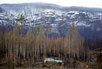
Mary Bradshaw's home in Elkhorn, shown here in this February 2021 file photo, survived the Beachie Creek fire in the area.
Kristyna Wentz-Graff / OPB
State Sen. Jeff Golden, D-Ashland, who led the effort to pass SB 762 last year, said the longer timeline is needed because the wildfire map and connected rules moved forward too quickly for people to understand and accept them.
“Oregonians said, ‘We’re not getting this, and we’re not on board,’” he said. “There’s another way to do this. We think we have a program that’s worth getting on board with, but we made some errors in the rollout.”
Golden said he’s now focusing on voluntary home hardening and defensible space work that’s already happening in communities across the state.
“I’m taking my focus off the map for right now,” he said. “I’m not saying we don’t need one. I’m saying we need something else first.”
ODF spokesperson Derek Gasperini said the appeals filed in response to the first wildfire risk map are now moot but will be considered as comments on how to improve the next version of the map. Property owners will have another window next year to file appeals of the new map after the state releases it.
Gasperini said there could be some significant changes in the next version, and some of those changes could be directed by Oregon lawmakers during the next legislative session.
He said many people couldn’t understand why they were classified as high risk after they had already cleared defensible space around their property and taken home hardening measures to reduce flammable materials in and around their homes. People were also confused about why their property had a different fire risk level from their neighbors, Gasperini said.
“We really want to take a look at classifications, neighborhood-by-neighborhood and property-by-property, to ensure we can better explain and make sense of those classifications,” he said.
The forestry department is working with Oregon State University to revise the map while other state agencies continue working on new building codes and land-use restrictions for high fire risk areas. A draft of the next wildfire risk map will be released to the public March 1, 2023.
