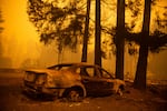
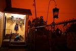
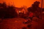
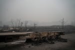
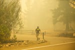
At least nine people have died in wildfires that have burned relentlessly across western Oregon. The Jackson County Sheriff’s Office on Saturday night confirmed three additional deaths in the Almeda Fire. As of Saturday, four people were confirmed dead in the Beachie Creek Fire and one person in the Holiday Farm Fire.
After five days of enormous wildfires consuming the landscape up and down the west side of the state, officials count more than 1 million acres burned and tens of thousands of people forced to leave their homes. Countless homes and businesses have been scorched, even as dry, hot weather that fueled the fires earlier in the week appears to be moderating.
Dozens of people remain unaccounted for in parts of Oregon. In some parts of the state, as much one-third of electricity consumers remained without power Saturday morning.
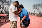
Dora Negrete is consoled consoled by her son Hector Rocha after seeing their destroyed mobile home at the Talent Mobile Estates, Thursday, Sept. 10, 2020, in Talent, Ore., after wildfires devastates the region.
Paula Bronstein / AP
Marion County says some areas safer now
The Marion County Sheriff’s Office announced Saturday that some towns threatened by the Beachie Creek Fire could downgrade from Level 2 to Level 1 evacuation status.
The agency moved Stayton, Sublimity, Aumsville, Silverton and Mt. Angel to the lower Level 1 “Get Set” status after closely consulting with fire officials managing the Beachie Creek Fire.
“In addition, the Army Corps of Engineers has been in communications with us and we’re working on determining when and where we can get the boats out of the lake, for those folks that have boats on Detroit Lake,” Sheriff Joe Kast said in a statement.
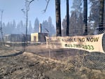
Many of the communities hardest hit by the Beachie Creek Fire remain under a Level 3 “Go Now” evacuation order. Those include Detroit, Idahna, Breitenbush, Lyons, Mehama, Mill City, Gates, the North Fork Road recreation area and Scotts Mills.
Air quality remains bad
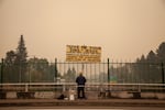
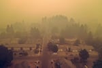
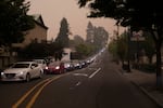
Poor air quality from the wildfire smoke is affecting much of the region — with Portland earning the unpleasant ranking as the major city with the worst air quality in the world, although smaller Oregon cities are enduring even worse air quality on both sides of the Cascades. On Saturday morning, an air quality warning was issued for the entire state and southwest Washington.
The smoke layer kept temperatures low and humidity levels high yesterday, aiding firefighting efforts. Favorable weather conditions are expected to continue Saturday.
These online tools offer up-to-the-minute emergency information on wildfires, evacuations and air quality in the Pacific Northwest:
- Northwest fires, Oregon evacuations: Oregon’s RAPTOR Map shows wildfires across the U.S. West and evacuation zones within the state. Enter an address to quickly zoom in on a specific location. It’s slow to load, so prepare for a brief wait before the map appears.
- Major Oregon and Washington fires: The Northwest Interagency Coordination Center, which coordinates firefighters across the region, shares this map of major fires in the Pacific Northwest
- Air Quality Index: Enter a zip code, town or address for the latest local air quality readings.
- BlueSky Canada has an interactive map showing wildfire smoke forecasts across the Pacific Northwest, including Oregon and Washington.
- Here are some practical tips — including a packing list — on how to prepare for a wildfire evacuation.
- PublicAlerts.org provides links to sign up for emergency phone and email alerts across the Portland-Vancouver metro area. Scroll to find your local jurisdiction.
- Outside the greater Portland metro area, alerts are handled by local governments. Search “Emergency Alerts” and your county’s name to find a link.
Fire challenges remain as weather improves
Mandatory Level 3 “Go Now” evacuations remain in place across numerous parts of the state, including a huge swath east of the Willamette River from northern Clackamas County south through Marion County into northern Linn County. Smaller evacuation zones cover parts of Douglas, Jackson, Josephine, Lane, Lincoln, Washington and Yamhill counties as well.
Firefighters made progress on the Lionshead Fire overnight, which started near Mount Jefferson and grew to merge with the Beachie Creek Fire (also known as the Santiam Fire) near Detroit, forcing fire crews and evacuees to make a harrowing escape through the burning forest.
Dry conditions allowed the Beachie Creek Fire to spread north toward the Riverside Fire Friday, but high nighttime humidity levels slowed the progress and allowed crews to continue to work on fire lines to the north and northwest. There are currently almost 14,000 structures under Level 3 “Go Now” evacuation orders from the Beachie Creek Fire.
Officials said the promised change in weather has allowed crews to continue containment operations and work to secure fire lines. Smoke from the fires blocked the sun, keeping temperatures cool and humidity high. Crews plan to build fire lines in the Warm Springs Reservation on Saturday and said they will backburn (start a small fire moving toward the larger fire) to create a "catcher’s mitt” of already-burned land along the northern and eastern edge of the fire. Crews were continuing to work to protect structures in the path of the fire in all directions.
The Two Four Two Fire continues to burn in Klamath County, but officials said Saturday that crews had completed a line around the fire, which was 7% contained as of mid-morning. The fire had destroyed eight homes and damaged 35 others as of the most recent report.
The Riverside Fire crept 2 miles closer to Estacada overnight Friday, and the leading edge was half a mile away from Estacada as of 9 a.m. Saturday. Officials planned to protect structures and build fire lines, as conditions allow. Officials said they expected better weather Saturday, as the smoke continues to block the sun. Still, they expect the fire to continue to progress northwest along both sides of the Clackamas River Corridor toward Estacada during the day and further overnight into Sunday. Some good news came late Saturday night as Clackamas County downgraded evacuation levels for Sandy, Oregon City and Canby to Level 1 “Be Ready” after making progress on the Riverside Fire.
Emergency officials downgraded evacuation zones for parts of Lincoln City, as cooler weather allowed crews to make progress on the Echo Mountain Complex Fire. The northern parts of the city, from Northwest 39th Street north to Road’s End, including the Chinook Winds Casino Resort, are under Level 2 “Get Set” evacuation orders as of Saturday. The area east of Devil’s Lake Road and adjoining streets were downgraded from Level 3 to Level 2, as was the Neotsu neighborhood. All evacuation notices have been removed for areas south of 39th and west of Devil’s Lake Road. The region around Highway 18 remains evacuated as of mid-morning Saturday.

Aaron Cleys holds a jug of water he was using to douse hot spots at a home destroyed by the Riverside Fire, Friday, Sept. 11, 2020, in Estacada, Ore.
John Locher / AP
The latest information on several of the largest fire areas, according to InciWeb, from the National Wildfire Coordinating Group:
The Beachie Creek Fire was listed Saturday morning as 186,000 acres burning east of Salem, just south of the 130,000-acre Riverside Fire in northern Marion and Clackamas counties. Just east of the Beachie Creek Fire is the Lionshead Fire measured at 136,000 acres and estimated to be 5% contained. Neither the Beachie Creek nor Riverside fires are listed as having any level of containment. Of the six fatalities confirmed from Oregon’s wildfires, the Beachie Creek Fire was responsible for four.
The Archie Creek Fire, burning in Douglas County, was measured at 115,000 acres Friday evening and also had no containment estimate.
The Holiday Farm Fire in Lane County has reached a size of 156,000 acres. It’s responsible for damage to communities near the McKenzie River, including Blue River and Vida. Firefighters have focused on protecting structures, and the fire was considered 0% contained.
The Almeda Fire, which burned through the southern Oregon communities of Phoenix and Talent earlier this week and forced the evacuation of homes in Medford, was listed at 5,700 acres and 20% contained, according to the state of Oregon’s hotspot dashboard.
The Echo Mountain Fire Complex was far smaller than Oregon’s largest blazes, but its location near populated areas in Lincoln County resulted in large numbers of evacuations. The fire was 2,400 acres in size, burning just inland from Lincoln City around the town of Otis.
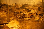
The remains of a home destroyed in the Santiam Fire near Gates, Ore., Sept. 9, 2020. Fires around Oregon could become the deadliest, costliest in state history.
Bradley W. Parks / OPB
Gov. Brown welcomes cooler weather to help firefighting efforts
Oregon Gov. Kate Brown and state fire officials sounded a new note of optimism Friday about wildfires that have devastated the state for days, noting that weather improved firefighting conditions around major blazes. But the improved news came with a caution: Oregon still has a long way to go before it’s out of danger.
“The weather system fueling these fires over the past few days has finally broken down and our firefighting teams tell me they can feel it,” Brown said at a media briefing. “We anticipate cooler air and moisture coming in the next few days.”
Gusting east winds that have sent fires storming down the west side of the Cascades since Monday have finally died down, giving way to cooler, moister air from the coast. Doug Grafe, fire chief at the Oregon Department of Forestry, said that will allow thousands of firefighters working more than a dozen large fires to take a more proactive stance.
“It’ll put us in a position to move from just life safety to offense against these fires,” Grafe said. “These conditions will carry through the weekend. This is positive firefighting weather for three days. It’ll continue to next week with more favorable conditions.”
Related: Improving weather conditions put Oregon firefighters on ‘offense’
Riverside Fire grows, may combine with Beachie Creek
Fire officials overseeing the Riverside Fire in Clackamas County said that, while more resources are available and the weather has improved, they are still fighting a very active fire with persistent danger.
According to an update on the National Wildfire Coordinating Group, erratic winds Thursday drove growth on all sides of the fire, which was estimated to be more than 130,000 acres on Friday afternoon. But winds in the area were considerably lighter Friday and humidity had increased. Fears that the Riverside and Beachie Creek fires would merge had yet to materialize by Friday evening.
“As of the most current infrared flight that we have, it still shows the Beachie Creek and Riverside fires, respectively, approximately one air mile apart,” said Holly Crake, the public information officer for the Riverside Fire incident management team. “It’s a very fluid and dynamic situation. We anticipate with a combination of weather and continued record dry fuel — timber and grass out there — that it’s likely the two might merge in the coming hours or potentially days.”
Related: Weather is improving, but Clackamas fires still grow
Evacuations, smoky air delay school programs in several Oregon districts
The Gresham-Barlow School District has canceled the first week of school due to the threat of wildfires and poor air quality.
The district said there were two major factors in the decision. Officials said some staff members live in evacuation zones, which could affect their availability for school. And they said the poor air quality forced them to cancel device distribution this week, which could leave students without the appropriate technology for distance learning.
Device distribution has been moved to next week. The district’s meal program begins Monday.
Another district in east Multnomah County, Reynolds, has canceled distance learning and meal distribution for Monday.
Both Eugene 4J and Springfield schools have also canceled school next week, and pushed the start of the school year to Sept. 21 due to wildfires.
Several districts in affected areas — including Oregon City and Molalla River — have postponed the start of the school year until further notice.
Related: Wildfires impacts on school: Meal and technology distribution canceled, first day of school delayed
