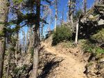
The U.S. Forest Service recently completed a new route across Eliot Creek that reconnects a longstanding gap in the Timberline Trail.
Courtesy of the U.S. Forest Service
For the past decade, hikers on the Timberline Trail have had to contend with a hazardous gap in the 40-mile loop around Mount Hood. Now, those days are gone. The U.S. Forest Service recently completed a new route that reconnects the loop.
The rugged trail winds its way through alpine forest and meadows, past waterfalls and over numerous glacier-fed drainages as it circumnavigates the volcano.
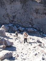
Crossing Eliot Creek on the northeast side of the mountain has always been a challenge. But when a debris flow took out the trail in 2006, the crossing got downright dangerous. The walls of the river canyon were steep and full of loose rock.
Andrew Sullivan is one of many hikers who found a way around that stretch when the Forest Service closed it.

After a debris flow washed out the old trail, some hikers would use ropes to climb down and back up the Eliot Creek drainage to complete the 40-mile Timberline Trail loop.
"The closed area was just an incredibly intense way to go," he said. “It became really treacherous to cross the canyon and come back up with big, Volkswagen-bug-size boulders sitting in a fairly steep field of sand and scree that could easily fall and injure people.”
Many hikers followed the old route despite the trail closure, using an unofficial set of ropes to cross the washed-out drainage, said Sullivan, who works at the outdoor store Next Adventure in Portland.
"I spend a lot of time looking at the Timberline Trail with folks and trying to show them the challenges," he said. "The trail is so iconic and beautiful that people continue to do it despite the hazards."
Sullivan preferred to take a different route, climbing more than 1,000 feet up along a ridge and across the Eliot Glacier instead of dropping down into the drainage.

A view from the edge of the Eliot Creek drainage, looking up toward the glacier.
OPB
"It's really beautiful, really thick ice, covered with some rocks and dirt," he said. "It's exposed. It's a lot of work to climb up there. I think a lot of people under-anticipate how long it takes to do the detour. It might add a few hours onto the hike and a lot of climbing and work to do it."
Now, completing the loop no longer requires a detour or rope climbing through scree fields.
The Forest Service recently reopened the full loop to the public with a new 1.5-mile re-route across Eliot Creek downstream of the original trail.
Sullivan says he tries to hike the loop every year, and he's looking forward to a new, safer route.
